Overview
- Brief Narrative
- British, 43 Series topographical silk escape map of Western Europe acquired by Captain Ralph M. Kopansky during his service as a US soldier in Europe from 1944 - 1945. Britain’s Military Intelligence Section, MI9, ran an escape and evasion program that issued this type of map to help soldiers find their way to safety if caught behind enemy lines. Silk maps were used because they were durable, made no noise, and were easy to conceal when carried by a soldier or smuggled into a prisoner of war camp in a board game or record. On September 22, 1941, Ralph, an Army reservist, enlisted for active duty. Following Japan’s December 7, 1941, attack on Pearl Harbor, the United States entered World War II. In 1943, he received intelligence training and was assigned to the XIII Corps as an Assistant Intelligence Officer. In 1944, Ralph’s Corps was deployed to Europe. The Corps trained in England, and fought in France, before advancing into Germany, in January 1945. On April 4, the XIII Corps was with the 4th Armored and the 89th Infantry Divisions when they liberated Ohrdruf concentration camp. During an inspection tour of the camp, Ralph was photographed viewing the charred remains of the prisoners. The photograph, 74589, is part of the Museum’s collection. On May 7, 1945, Germany surrendered.
- Title
- Belgium and Germany (New Frontier), - Sheet C/43C- Sheet D/43D
- Date
-
publication:
1943
- Geography
-
publication:
Leeds (England)
- Credit Line
- United States Holocaust Memorial Museum Collection, Gift of Dr. Terry Kopansky
- Markings
- front, top, left side of legend box, black dye : LEGEND / Important Through Roads / Other Main Roads / Subsidiary Roads / Special Motorways (Autobahnen, etc.) under construction / Numbers of Routes Nationales / Distances in Kilometres between black dots or bars / Railways / Canals / International Frontiers / Former frontiers / HOLLAND / BELGIUM / (EXCEPT WEST COAST) / FRANCE / (NORTH EAST) / GERMANY / (WEST & CENTRAL) / For enlargement of / NEW / GERMAN - BELGIUM / FRONTIER / see inset Sheet “D” / turn over
front, top, center of legend box, black dye : SCALE 1 : 1,000,000 / English Miles / Kilometres / The Heights engraved on the map are in Metres
front, top right, black dye : SHEET C / OVERLAPS SOUTH MARGIN OF FG S/E. 43 / C
front, left side margin, black dye : OVERLAPS EAST MARGIN OF SHEET "A" ; front, right side margin, black dye : OVERLAPS WEST MARGIN OF SHEET 43/E ; front, bottom center margin, black dye : OVERLAPS NORTH MARGIN OF SHEET "D" (turn over)
back, center and top right corner, black dye : OVERLAPS SOUTH MARGIN OF SHEET "C" (turn over) 43/D
back, bottom left, left side of legend box, black dye : FRANCE / (SOUTH EAST) / GERMANY / (SOUTH WEST) / SWITZERLAND / (EXCEPT SOUTH EAST) / ABOVE / (FOR ENLARGEMENT OF GERMAN-Swiss FRONTIER see inset Sheet “B”) / Scale = 1 : 1,000,000 / English Miles / Kilometres / LEGEND / Important Through Roads / Other Main Roads / Subsidiary Roads / Special Motorways (Autobahnen, etc.) / Numbers of Routes Nationales / Line of Demarcation / Distances in kilometres between black dots or bars / Railways / Canals / International Frontier / Former Frontier / The Heights engraved on the map are in Metres
back, bottom, within box, black dye : SHEET / D
back, bottom center, within box, black dye : INSET / RIGHT / BELGIUM & GERMANY / (NEW FRONTIER) / 1 : 250,000 / Scale 1 Inch to 3-945 Miles, / or 1-014 Inches to 4 Miles. / Miles / Kilometres / 1 Centimetre to 2-5 Kilometres. / LEGEND / Churches / Forts / Lighthouses / Heights in metres / Contour interval 50 metres / Woods in green, Orchards are not shown / Railways (double) with Station / “ (single) “ “ / “ narrow gauge or Tramway / Roads main (macadamized or paved) with Tramway / ” secondary / “ minor / Former Frontiers / Present Frontiers
back, right side margin, black dye : OVERLAPS EAST MARGIN OF SHEET "B" ; back, upper left side margin, black dye : OVERLAPS WEST MARGIN OF SHEET 43/F - Contributor
-
Subject:
Ralph M. Kopansky
Publisher: John Waddington, Ltd
Author: MI9, Great Britain
- Biography
-
Ralph Morris Kopansky was born on May 23, 1912, in Minneapolis, Minnesota. He was the second of three children born to Sam and Ida Goseman Kopansky. His parents and older sister, Esther (later Fisher), were born in Russia and immigrated to the United States. Sam worked as a clothing dyer. In 1924, Ralph’s younger sister Lillian died. Ralph graduated from high school and went on to receive degrees from the University of Minnesota and the Minnesota College of Law. While attending law school, Ralph worked as a part time general investigator for Carlton Investigative Agency and served in the US Army Reserve. In July 1940, Ralph married Alice Whitver (1914 – 1981). After receiving training, Ralph became an Immigration Patrol Inspector in Ogdensburg, New York. On September 22, 1941, Ralph enlisted for active duty in the Army.
On December 7, 1941, Japan attacked Pearl Harbor, and a few days later America entered World War II. In 1943, Ralph was selected for training at Army intelligence school in Chicago, Illinois. As a Captain, he was assigned to the U.S. Army Headquarters XIII Corps, 9th Army, where he served as an Assistant Intelligence Officer. In 1944, Ralph’s Corps was deployed to England for additional training and his and Alice’s first son was born. The Corps fought in France, and by mid-January 1945, had crossed the Siegfried Line and advanced into Germany. On April 4, Ralph’s Corps was with the 4th Armored and the 89th Infantry Divisions, Third Army, when they liberated Ohrdruf concentration camp, a subcamp of Buchenwald and the first concentration camp liberated by US troops. The majority of the inhabitants were dead and many of the remains were badly charred. On orders from higher-up, the guards had “exhumed and burned 1,606 murdered victims in six days in an attempt to destroy the evidence” before evacuating the camp in advance of the arrival of US Army forces. Many other prisoners, too weak or sick to be evacuated, were shot by members of the SS before the US Army arrived. Ralph, part of an inspection tour of the camp, was photographed viewing "the charred remains of burned prisoners shortly after capture of the area.” On May 7, Germany surrendered. Ralph received a Bronze Star and numerous letters of commendation for meritorious service.
In January 1946, he was released from active duty as a Major, the Military Intelligence Chief of the XIII Corps, and returned to the Army Reserve. In January 1947, the couple’s second son was born. Later that year, Ralph began a successful career with the US Atomic Energy Commission. First serving as the Chief of Police in Los Alamos, New Mexico, and in the late 1950’s, becoming a Branch Manager in Clarksville, Tennessee. Ralph was an active member of several police associations, the American Legion, Lions Club, the PTA, and served as a board member for several additional groups. In 1962, he retired from the Army Reserve as a Lieutenant Colonel. In 1973, he retired and settled in Santa Fe, New Mexico. Ralph, 66, died on July 1, 1978, in Albuquerque, New Mexico.
Physical Details
- Language
- English
- Classification
-
Information Forms
- Category
-
Maps
- Object Type
-
Military maps (lcsh)
- Physical Description
- Double sided, square, vividly colored silk topographical map of Germany and bordering Western European nations with an inset of the new frontier between Germany and Belgium. Country names are printed in uppercase blue letters and cities and towns in black; the background is offwhite with a light brown border, water in blue, and mountains and elevated areas in yellow and orange. The scale is 1: 1,000,000, with longitude and latitude in the map border. The front is Sheet C, 43/C and maps Holland, Belgium (Except West Coast), France (North East), and Germany (West & Central), as well as Luxembourg. The back is Sheet D, 43/D and maps France (South East), Germany (South West), and Switzerland (Except South East.); the inset: Belgium & Germany (New Frontier.) Legend includes elevation scale, important roadway features, former and present frontiers.
- Dimensions
- overall: Height: 28.750 inches (73.025 cm) | Width: 28.625 inches (72.708 cm)
- Materials
- overall : silk, dye
Rights & Restrictions
- Conditions on Access
- No restrictions on access
- Conditions on Use
- No restrictions on use
Keywords & Subjects
Administrative Notes
- Legal Status
- Permanent Collection
- Provenance
- The escape map was donated to the United States Holocaust Memorial Museum in 2017 by Dr. Terry Kopansky, the son of Ralph Kopansky.
- Funding Note
- The cataloging of this artifact has been supported by a grant from the Conference on Jewish Material Claims Against Germany.
- Record last modified:
- 2022-07-28 20:14:01
- This page:
- https://collections.ushmm.org/search/catalog/irn561707
Download & Licensing
In-Person Research
- By Appointment
- Request 21 Days in Advance of Visit
- Plan a Research Visit
- Request to See This Object
Contact Us
Also in Ralph M. Kopansky collection
The collection consists of a camera, camera accessories, tobacco pipes, silk maps, an armband, documents, and photographs relating to the experiences of Ralph Kopansky in the United States Army before, during, and after World War II, including the liberation of Ohrdruf concentration camp, where he carried his Leica camera.
Date: 1943-1963
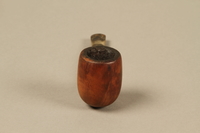
Barling’s briar wood straight billiard pipe used by American soldier and liberator
Object
Barling’s pre-transition, Ye Olde Wood pipe used by Captain Ralph M. Kopansky during his service as a US soldier in Europe from 1944 - 1945. This line of pipes was made to be among the best smoking instruments in the world and carved from the company’s signature, highest quality briar wood, which was sourced, harvested, and seasoned under the direct control of the Barling family. On September 22, 1941, Ralph, an Army reservist, enlisted for active duty. Following Japan’s December 7, 1941, attack on Pearl Harbor, the United States entered World War II. In 1943, he received intelligence training and was assigned to the XIII Corps as an Assistant Intelligence Officer. In 1944, Ralph’s Corps was deployed to Europe. The Corps trained in England, and fought in France, before advancing into Germany, in January 1945. On April 4, the XIII Corps was with the 4th Armored and the 89th Infantry Divisions when they liberated Ohrdruf concentration camp. During an inspection tour of the camp, Ralph was photographed viewing the charred remains of the prisoners. The photograph, 74589, is part of the Museum’s collection. On May 7, 1945, Germany surrendered.
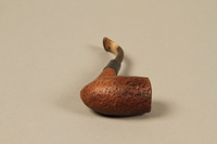
Briar wood bent Dublin pipe used by American soldier and liberator
Object
Bent briar wood pipe used by Captain Ralph M. Kopansky during his service as a US soldier in Europe from 1944 - 1945. This pipe was designed with the comfort of the smoker in mind: carved from high quality briar wood, the best material for pipes, and utilizing a bent stem design that allows it to hang comfortably from the mouth for hands free smoking. On September 22, 1941, Ralph, an Army reservist, enlisted for active duty. Following Japan’s December 7, 1941, attack on Pearl Harbor, the United States entered World War II. In 1943, he received intelligence training and was assigned to the XIII Corps as an Assistant Intelligence Officer. In 1944, Ralph’s Corps was deployed to Europe. The Corps trained in England, and fought in France, before advancing into Germany, in January 1945. On April 4, the XIII Corps was with the 4th Armored and the 89th Infantry Divisions when they liberated Ohrdruf concentration camp. During an inspection tour of the camp, Ralph was photographed viewing the charred remains of the prisoners. The photograph, 74589, is part of the Museum’s collection. On May 7, 1945, Germany surrendered.
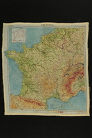
Silk escape map of France owned by a US soldier
Object
British topographical silk escape map of France acquired by Captain Ralph M. Kopansky during his service as a US soldier in Europe from 1944 - 1945. Britain’s Military Intelligence Section, MI9, ran an escape and evasion program that issued this type of map to help soldiers find their way to safety if caught behind enemy lines. Silk maps were used because they were durable, made no noise, and were easy to conceal when carried by a soldier or smuggled into a prisoner of war camp in a board game or record. On September 22, 1941, Ralph, an Army reservist, enlisted for active duty. Following Japan’s December 7, 1941, attack on Pearl Harbor, the United States entered World War II. In 1943, he received intelligence training and was assigned to the XIII Corps as an Assistant Intelligence Officer. In 1944, Ralph’s Corps was deployed to Europe. The Corps trained in England, and fought in France, before advancing into Germany, in January 1945. On April 4, the XIII Corps was with the 4th Armored and the 89th Infantry Divisions when they liberated Ohrdruf concentration camp. During an inspection tour of the camp, Ralph was photographed viewing the charred remains of the prisoners. The photograph, 74589, is part of the Museum’s collection. On May 7, 1945, Germany surrendered.
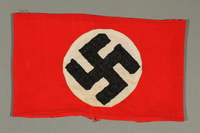
Red armband with swastika acquired by American soldier and liberator
Object
Nazi swastika armband acquired by Captain Ralph M. Kopansky during his service as a US soldier in Europe from 1944 - 1945. On September 22, 1941, Ralph, an Army reservist, enlisted for active duty. Following Japan’s December 7, 1941, attack on Pearl Harbor, the United States entered World War II. In 1943, he received intelligence training and was assigned to the XIII Corps as an Assistant Intelligence Officer. In 1944, Ralph’s Corps was deployed to Europe. The Corps trained in England, and fought in France, before advancing into Germany, in January 1945. On April 4, the XIII Corps was with the 4th Armored and the 89th Infantry Divisions when they liberated Ohrdruf concentration camp. During an inspection tour of the camp, Ralph was photographed viewing the charred remains of the prisoners. The photograph, 74589, is part of the Museum’s collection. On May 7, 1945, Germany surrendered.
Captain Ralph Kopansky papers
Document
Consists of photographs of Captain Ralph Kopansky's experiences in the United States military during World War II, including at the liberation of the Ohrdruf concentration camp. Also includes photographs and documents related to Captain Kopansky's post-war life.
Leica Standard model E camera used by US soldier and liberator
Object
Leica Standard model E camera used by Captain Ralph M. Kopansky during his service as a US soldier in Europe from 1944 – 1945. This rollfilm camera was designed as a basic, but high quality model upgrade from the earlier, very popular Leica I. On September 22, 1941, Ralph, an Army reservist, enlisted for active duty. Following Japan’s December 7, 1941, attack on Pearl Harbor, the United States entered World War II. In 1943, he received intelligence training and was assigned to the XIII Corps as an Assistant Intelligence Officer. In 1944, Ralph’s Corps was deployed to Europe. The Corps trained in England, and fought in France, before advancing into Germany, in January 1945. On April 4, the XIII Corps was with the 4th Armored and the 89th Infantry Divisions when they liberated Ohrdruf concentration camp. During an inspection tour of the camp, Ralph was photographed viewing the charred remains of the prisoners, a camera, likely this Leica, around his neck. The photograph, 74589, is part of the Museum’s collection. On May 7, 1945, Germany surrendered.
