Overview
- Brief Narrative
- A 1961 map of the Bergen-Hohne region, with an overprinted boundary of the North Atlantic Treaty Organization (NATO) training area, acquired by an American soldier stationed in Germany during the 1980s. Overprinted maps are often made prior to or during hostilities. They provide military units with the most up-to-date intelligence and information, when there is insufficient time to fully revise or create a new map. Along the bottom right edge of the NATO range, outlined in purple, is the village of Belsen, located next to the “East Camp” of a former Wehrmacht training complex, founded in 1934. Southwest of the installation was the complex’s construction camp, which was a prisoner of war (POW) camp in 1940, and became Bergen-Belsen concentration camp in 1943. Following the liberation of Bergen-Belsen on April 15, 1945, British forces took control of the area and set up 14,000 emergency hospital beds in the military complex. An estimated 50,000 people died while imprisoned or within months of leaving the concentration camp. In 1949, the NATO military alliance was formed to counter the communist military threat of Eastern Europe. NATO continued to use the Bergen-Hohne region as a training range. The British army maintained a garrison at the Bergen-Hohne military complex until 2015, and as the largest military training area in Germany, with 70,000 acres, it is still used as an active training range for international forces.
- Title
- NATO-Schießplatz Bergen-Hohne
- Date
-
publication:
1961-1962
- Geography
-
depiction:
Bergen (Celle, Germany)
- Credit Line
- United States Holocaust Memorial Museum Collection, Gift of Joseph Pallone
- Markings
- front, top left corner, printed, black ink : Deutschland 1 : 50 000 [Germany 1 : 50 000]
front, top left margin, printed, black ink : NATO-Range Bergen-Hohne NATO-Champ de tir Bergen-Hohne [NATO-Shooting range Bergen-Hohne]
front, top center, printed, black ink : NATO-Schießplatz Bergen-Hohne [NATO-Shooting range Bergen-Hohne]
front, top margin, printed, black ink : westlich (number scale) ostwärts [west (number scale) east]
front, top right corner, printed, black ink : Ausgabe 5-DMG Serie M 74-TR -Z(inscription, printed , purple ink) 29 [Version 5-DMG Series M74-TR - Z (page) 29] - Contributor
-
Subject:
NATO (North Atlantic Treaty Organization)
- Biography
-
The North Atlantic Treaty Organization (NATO) was founded in 1949, in the aftermath of World War II. Originally an alliance of 12 Western European and North American countries, the alliance has expanded to 29 member states. The alliance was created for the collective defense of member states from attack through political and military means. The political headquarters are located in Brussels, Belgium. The military command structure is headed by two Strategic Commands: the Allied Command Operations (ACO), based in Mons, Belgium, and the Allied Command Transformation (ACT), based in Norfolk, Virginia, United States.
Physical Details
- Classification
-
Information Forms
- Category
-
Maps
- Object Type
-
Military maps (lcsh)
- Genre/Form
- Maps.
- Physical Description
- Rectangular sheet of off-white paper with multiple layers of printed maps depicting the Bergen-Hohne region of Germany. The base map is printed in black ink, surrounded by a triple-line border and is divided evenly into a grid of squares, 22 squares across by 28 down. The vertical lines are numbered left to right, from 545 000 mE to 567, and the horizontal lines are numbered bottom to top from 5840 000 mN to 5868. Each corner is marked with a pair of coordinates in degrees-minutes-seconds, and each axis contains a series of hash marks, subdividing it into minutes. Printed over the map in purple ink are boundary markers, symbols, and place names indicating in certain areas. Additionally, a German inscription and three small outlined areas are handwritten in red ink. The map has been trimmed close to the border, except for the top margin, which contains a scale, titles, and other series printing information. The lower half of the left margin is also partially intact, containing two punched holes. On the back, there is a handwritten inscription in purple ink. The paper is creased with multiple small tears, and shows wear from use.
- Dimensions
- overall: Height: 23.500 inches (59.69 cm) | Width: 18.375 inches (46.673 cm)
- Materials
- overall : paper, ink
- Inscription
- front, top center, printed, purple ink : Übungsplatzanlagen [Training ground facilities]
front, top right corner, printed, purple ink : Stand: VIII. 1961 [Standard August 1961]
front, top right corner, printed, purple ink : Serie M 74 – TR(marking, printed, black ink) – Z
front, on map, right side, handwritten, red ink : Zeltlager-plätze / Vorschläge seiten Kdtr. / 18.12.62 [Tent camp-locations / Suggestions on the side of the commandant / 18 December 1962]
back, top, handwritten, purple ink : Trüppe Bergen 1:500 00 / 1961 [Troops Bergen scale / overlay publication year]
Rights & Restrictions
- Conditions on Access
- No restrictions on access
- Conditions on Use
- No restrictions on use
Keywords & Subjects
Administrative Notes
- Legal Status
- Permanent Collection
- Provenance
- The map was donated to the United States Holocaust Memorial Museum in 2018 by Joseph Pallone.
- Record last modified:
- 2023-08-25 12:38:05
- This page:
- https://collections.ushmm.org/search/catalog/irn619014
Download & Licensing
In-Person Research
- By Appointment
- Request 21 Days in Advance of Visit
- Plan a Research Visit
- Request to See This Object
Contact Us
Also in Joseph Pallone collection
The collection consists of two over-printed maps of the area around Bergen-Hohne, Germany, acquired by an American soldier stationed in Germany during the 1980s.
Date: after 1942 November-before 1962 December 18
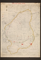
Rhine Army Ranges (Hohne) map with overprinting, acquired by an American soldier stationed in Germany during the 1980s
Object
A 1953 map of the Bergen-Hohne region, with multi-colored overprinting of the North Atlantic Treaty Organization (NATO) training area, acquired by an American soldier stationed in Germany during the 1980s. Overprinted maps are often made prior to or during hostilities. They provide military units with the most up-to-date intelligence and information, when there is insufficient time to fully revise or create a new map. Along the bottom right edge of the NATO range, outlined in yellow and black, is the village of Belsen, located next to the “East Camp” of a former Wehrmacht training complex, founded in 1934. Southwest of the installation was the complex’s construction camp, which was a prisoner of war (POW) camp in 1940, and became Bergen-Belsen concentration camp in 1943. Following the liberation of Bergen-Belsen on April 15, 1945, British forces took control of the area and set up 14,000 emergency hospital beds in the military complex. On August 25, 1945, the British Army of the Rhine (BAOR) was formed, stationing 80,000 soldiers in Germany. In 1949, the NATO military alliance was formed to counter the communist military threat of Eastern Europe. NATO continued to use the Bergen-Hohne region as a training range. In November 1952, NATO created the Headquarters of Northern Army Group (NORTHAG), which incorporated the BAOR. The British army maintained a garrison at the Bergen-Hohne military complex until 2015, and as the largest military training area in Germany, with 70,000 acres, it is still used as an active training range for international forces.
