Overview
- Brief Narrative
- Hand-colored printed map of the forest camp of Chelmno killing center in German-occupied Poland, produced following archaeological excavations in 1986 and 1987. Killing operations at Chelmno were split between two locations, a manor house (Schlosslager) in the village and a camp in the Rzuchowski forest (Waldlager) 2.5 miles northwest of the village. The large number of corpses created a threat of disease and discovery by Allied forces, so the bodies were exhumed and burned in seven primitive pit furnaces. In the fall of 1942, the furnaces were replaced with two open-air crematoria consisting of concrete foundations topped by a grate of train rails. In March 1943, the manor house and open-air crematoria in the forest were demolished. Killing operations at Chelmno resumed from June to July 1944, and were carried out entirely in the forest camp, necessitating the construction of new buildings. The Germans abandoned the camp on January 17, 1945, having killed over 172,000 people. The map is a compilation of information from field photos taken in in 1958 and 1979; maps drawn in 1951, 1961, and 1987; and oral information from 1989. It identifies features found through archaeological excavations between 1951 and 1989. The excavations of 1986-87, and later work have identified additional furnaces, crematoria, and mass graves at the site.
- Title
- PLAN BYŁEGO OBOZU ZAGŁADY w CHEŁMNIE NAD NEREM
- Alternate Title
- MAP OF THE FORMER EXTERMINATION CAMP IN CHELMNO ON THE NER
- Date
-
creation:
1989
depiction: 1986-1989
- Geography
-
depiction:
Chelmno (Concentration camp);
Chełmno (Konin, Poland)
creation: Muzeum Okre̦gowe w Koninie; Konin (Poland : Voivodeship)
- Credit Line
- United States Holocaust Memorial Museum Collection, Gift of Muzeum Okręgowe w Koninie
- Markings
- top, printed, purple ink: PLAN BYŁEGO / OBOZU ZAGŁADY w CHEŁMNIE / NAD NEREM [PLAN OF THE FORMER EXTERMINATION CAMP IN CHELMNO ON THE NER]
top right, printed, purple ink: KWATERA I [QUARTER 1]
center, printed, purple ink: KWATERA II / (miejsce mordowania i grze- / bania pierwszych partii / żydów) / KWATERA III / (1951r.-ślady masowej mogiły 180x7m i pieca / krematorium polowego) [QUARTER 2 / (place of murdering and burying the first batch of Jews) / QUARTER 3 / (1951 - traces of a mass grave 180x7m and field crematorium furnace)]
lower left, printed, purple ink: KWATERA IV / (1951r.-ślady trzech mogił 150x5m / i w części SE krematorium polo- / wego) [QUARTER 4 / (1951.-traces of three graves 150x5m and in part SE of the field crematorium)]
legend, bottom, printed, purple ink: SKALA 1:1000 / Aktualna powierzchnia 8,92 ha / Na podstawie zdjęć lołniczych (1958, 1979) i ich / fołointerpretacji, planów i map sytuacyjnych (1951, / 1961, 1987), oraz informacji ustnych (1989) wyko- / nał : / Zdzislaw LOREK / Muzeum Okregow / KONIN 1989. [SCALE 1 : 1000 / Current area 8.92 ha / On the basis of field photos (1958, 1979) and their interpretation, plans and situational maps (1951, / 1961, 1987), and oral information (1989) made / produced by: / Zdzislaw LOREK / District Museum / KONIN 1989.] - Contributor
-
Creator:
Zdzislaw Lorek
Publisher: Muzeum Okregowe w Koninie
Physical Details
- Language
- Polish
- Classification
-
Information Forms
- Category
-
Maps
- Object Type
-
Maps (lcsh)
- Genre/Form
- Site plans.
- Physical Description
- Hand-colored archaeological map, printed in purple ink on a rectangular sheet of off-white paper, depicting the area of Chelmno killing center in the Rzuchowski forest. The base map is printed in purple ink, outlining the layout of the site. The irregular, uncolored shapes represent open grassy areas, which are labeled from top to bottom as Kwatera I-IV. The four areas have no clear divisions between them. Dashed lines shaded with green and yellow represent forested areas. In the upper right corner, printed in purple, is an open rectangle with a cross inside, representing the mass grave of Polish hostages killed in 1939. In the middle of the map, within one of the green areas, is a rhombus with a pattern of crosses on the interior, representing a symbolic grave for children from Lidice. In the lower left uncolored section of the map are two sets of small boxes. Five boxes outlined and shaded in red represent crematorium furnaces from 1944; five boxes shaded in yellow represent unnamed features. In the center of the page are long, thin rectangles shaded in blue, and a smaller blue rectangle representing Jewish graves and a mass grave. Near the blue features are four small, purple rectangles, representing other areas of excavation. Also depicted on the map are symbols representing monuments and plaques, former railroad tracks, and the unconfirmed locations of other features. The legend is located in a large rectangle on the lower right side. Below the legend, in the bottom right corner are two inset, circular maps and a printed north arrow. The maps show the location of the site in relation to the city of Konin, and the location of Chelmno within a larger district. The edges of the paper are slightly creased and worn, and the paper has yellowed with age.
- Dimensions
- overall: Height: 37.000 inches (93.98 cm) | Width: 22.375 inches (56.833 cm)
- Materials
- overall : paper, ink, colored pencil
Rights & Restrictions
- Conditions on Access
- No restrictions on access
- Conditions on Use
- No restrictions on use
Keywords & Subjects
- Topical Term
- Archaeology and history. Crematoriums--Poland. Execution sites--Excavation--Material culture. Executions and executioners--Poland--History. Exhumation--Cremation--Poland. Mass burials--Poland. World War, 1939-1945--Occupied territories.
- Geographic Name
- Chełmno (Koło, Poland) Rzuchowa (Poland)
- Corporate Name
- Chelmno (Concentration camp)
Administrative Notes
- Legal Status
- Permanent Collection
- Provenance
- The map was donated to the United States Holocaust Memorial Museum in 1989 by the Muzeum Okręgowe w Koninie.
- Record last modified:
- 2024-04-29 07:56:45
- This page:
- https://collections.ushmm.org/search/catalog/irn1096
Download & Licensing
In-Person Research
- By Appointment
- Request 21 Days in Advance of Visit
- Plan a Research Visit
- Request to See This Object
Contact Us
Also in Muzeum Okregowe w Konine collection
The collection consists of concrete, a map, utensils, clothing accessories, and other small personal artifacts recovered from the site of Chelmno killing center operated by the German SS and police authorities in German-occupied Poland.
Date: 1941-1945
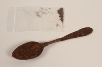
Rusted tablespoon recovered from Chelmno killing center
Object
Metal tablespoon, likely recovered from a temporary pit furnace at Chelmno killing center in German-occupied Poland, during an archaeological excavation in 1986 and 1987. Killing operations at Chelmno commenced on December 8, 1941. Prisoners were taken to a camp at a manor house (Schlosslager) in the village to undress and relinquish their valuables. They were then loaded into a gas van where they were killed. The van was then driven 2.5 miles northwest of the village to a camp in the Rzuchowski forest (Waldlager), where the bodies were dumped into mass graves. The large number of corpses created a threat of disease and discovery by Allied forces, so the bodies were exhumed and burned in seven primitive pit furnaces. In the fall of 1942, the furnaces were replaced with two open-air crematoria consisting of concrete foundations topped by a grate of train rails. In March 1943, transports to Chelmno stopped, and the manor house and open-air crematoria in the forest were demolished. Deportations to Chelmno resumed from June to July 1944, to facilitate the liquidation of the Łódź ghetto. In this second phase, the entire killing process was carried out in the forest camp (Waldlager), necessitating the construction of new buildings. The Germans abandoned the camp on January 17, 1945, having killed over 172,000 people. The excavations of 1986-87, and later work have identified additional furnaces, crematoria, and mass graves at the site.
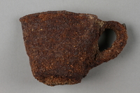
Rusted, crushed cup recovered from Chelmno killing center
Object
Metal cup, likely recovered from a temporary pit furnace at Chelmno killing center in German-occupied Poland, during an archaeological excavation in 1986 and 1987. Killing operations at Chelmno commenced on December 8, 1941. Prisoners were taken to a camp at a manor house (Schlosslager) in the village to undress and relinquish their valuables. They were then loaded into a gas van where they were killed. The van was then driven 2.5 miles northwest of the village to a camp in the Rzuchowski forest (Waldlager), where the bodies were dumped into mass graves. The large number of corpses created a threat of disease and discovery by Allied forces, so the bodies were exhumed and burned in seven primitive pit furnaces. In the fall of 1942, the furnaces were replaced with two open-air crematoria consisting of concrete foundations topped by a grate of train rails. In March 1943, transports to Chelmno stopped, and the manor house and open-air crematoria in the forest were demolished. Deportations to Chelmno resumed from June to July 1944, to facilitate the liquidation of the Łódź ghetto. In this second phase, the entire killing process was carried out in the forest camp (Waldlager), necessitating the construction of new buildings. The Germans abandoned the camp on January 17, 1945, having killed over 172,000 people. The excavations of 1986-87, and later work have identified additional furnaces, crematoria, and mass graves at the site.
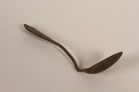
Metal teaspoon recovered from Chelmno killing center
Object
Metal teaspoon, likely recovered from a temporary pit furnace at Chelmno killing center in German-occupied Poland, during an archaeological excavation in 1986 and 1987. Killing operations at Chelmno commenced on December 8, 1941. Prisoners were taken to a camp at a manor house (Schlosslager) in the village to undress and relinquish their valuables. They were then loaded into a gas van where they were killed. The van was then driven 2.5 miles northwest of the village to a camp in the Rzuchowski forest (Waldlager), where the bodies were dumped into mass graves. The large number of corpses created a threat of disease and discovery by Allied forces, so the bodies were exhumed and burned in seven primitive pit furnaces. In the fall of 1942, the furnaces were replaced with two open-air crematoria consisting of concrete foundations topped by a grate of train rails. In March 1943, transports to Chelmno stopped, and the manor house and open-air crematoria in the forest were demolished. Deportations to Chelmno resumed from June to July 1944, to facilitate the liquidation of the Łódź ghetto. In this second phase, the entire killing process was carried out in the forest camp (Waldlager), necessitating the construction of new buildings. The Germans abandoned the camp on January 17, 1945, having killed over 172,000 people. The excavations of 1986-87, and later work have identified additional furnaces, crematoria, and mass graves at the site.
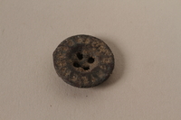
Small metal button recovered from Chelmno killing center
Object
Metal button, likely recovered from a temporary pit furnace at Chelmno killing center in German-occupied Poland, during an archaeological excavation in 1986 and 1987. Killing operations at Chelmno commenced on December 8, 1941. Prisoners were taken to a camp at a manor house (Schlosslager) in the village to undress and relinquish their valuables. They were then loaded into a gas van where they were killed. The van was then driven 2.5 miles northwest of the village to a camp in the Rzuchowski forest (Waldlager), where the bodies were dumped into mass graves. The large number of corpses created a threat of disease and discovery by Allied forces, so the bodies were exhumed and burned in seven primitive pit furnaces. In the fall of 1942, the furnaces were replaced with two open-air crematoria consisting of concrete foundations topped by a grate of train rails. In March 1943, transports to Chelmno stopped, and the manor house and open-air crematoria in the forest were demolished. Deportations to Chelmno resumed from June to July 1944, to facilitate the liquidation of the Łódź ghetto. In this second phase, the entire killing process was carried out in the forest camp (Waldlager), necessitating the construction of new buildings. The Germans abandoned the camp on January 17, 1945, having killed over 172,000 people. The excavations of 1986-87, and later work have identified additional furnaces, crematoria, and mass graves at the site.
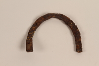
Rusted horseshoe-shaped heelplate recovered from Chelmno killing center
Object
Metal heel plate, likely recovered from a temporary pit furnace at Chelmno killing center in German-occupied Poland, during an archaeological excavation in 1986 and 1987. Killing operations at Chelmno commenced on December 8, 1941. Prisoners were taken to a camp at a manor house (Schlosslager) in the village to undress and relinquish their valuables. They were then loaded into a gas van where they were killed. The van was then driven 2.5 miles northwest of the village to a camp in the Rzuchowski forest (Waldlager), where the bodies were dumped into mass graves. The large number of corpses created a threat of disease and discovery by Allied forces, so the bodies were exhumed and burned in seven primitive pit furnaces. In the fall of 1942, the furnaces were replaced with two open-air crematoria consisting of concrete foundations topped by a grate of train rails. In March 1943, transports to Chelmno stopped, and the manor house and open-air crematoria in the forest were demolished. Deportations to Chelmno resumed from June to July 1944, to facilitate the liquidation of the Łódź ghetto. In this second phase, the entire killing process was carried out in the forest camp (Waldlager), necessitating the construction of new buildings. The Germans abandoned the camp on January 17, 1945, having killed over 172,000 people. The excavations of 1986-87, and later work have identified additional furnaces, crematoria, and mass graves at the site.
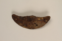
Rusted heel plate with screw recovered from Chelmno killing center
Object
Metal heel plate, likely recovered from a temporary pit furnace at Chelmno killing center in German-occupied Poland, during an archaeological excavation in 1986 and 1987. Killing operations at Chelmno commenced on December 8, 1941. Prisoners were taken to a camp at a manor house (Schlosslager) in the village to undress and relinquish their valuables. They were then loaded into a gas van where they were killed. The van was then driven 2.5 miles northwest of the village to a camp in the Rzuchowski forest (Waldlager), where the bodies were dumped into mass graves. The large number of corpses created a threat of disease and discovery by Allied forces, so the bodies were exhumed and burned in seven primitive pit furnaces. In the fall of 1942, the furnaces were replaced with two open-air crematoria consisting of concrete foundations topped by a grate of train rails. In March 1943, transports to Chelmno stopped, and the manor house and open-air crematoria in the forest were demolished. Deportations to Chelmno resumed from June to July 1944, to facilitate the liquidation of the Łódź ghetto. In this second phase, the entire killing process was carried out in the forest camp (Waldlager), necessitating the construction of new buildings. The Germans abandoned the camp on January 17, 1945, having killed over 172,000 people. The excavations of 1986-87, and later work have identified additional furnaces, crematoria, and mass graves at the site.
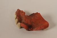
Partial upper plate of a denture with five teeth recovered from Chelmno killing center
Object
Fragment of an upper denture, likely recovered from a temporary pit furnace at Chelmno killing center in German-occupied Poland, during an archaeological excavation in 1986 and 1987. Killing operations at Chelmno commenced on December 8, 1941. Prisoners were taken to a camp at a manor house (Schlosslager) in the village to undress and relinquish their valuables. They were then loaded into a gas van where they were killed. The van was then driven 2.5 miles northwest of the village to a camp in the Rzuchowski forest (Waldlager), where the bodies were dumped into mass graves. The large number of corpses created a threat of disease and discovery by Allied forces, so the bodies were exhumed and burned in seven primitive pit furnaces. In the fall of 1942, the furnaces were replaced with two open-air crematoria consisting of concrete foundations topped by a grate of train rails. In March 1943, transports to Chelmno stopped, and the manor house and open-air crematoria in the forest were demolished. Deportations to Chelmno resumed from June to July 1944, to facilitate the liquidation of the Łódź ghetto. In this second phase, the entire killing process was carried out in the forest camp (Waldlager), necessitating the construction of new buildings. The Germans abandoned the camp on January 17, 1945, having killed over 172,000 people. The excavations of 1986-87, and later work have identified additional furnaces, crematoria, and mass graves at the site.
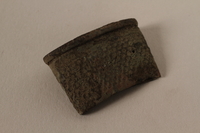
Metal tailor's thimble recovered from Chelmno killing center
Object
Metal thimble, likely recovered from a temporary pit furnace at Chelmno killing center in German-occupied Poland, during an archaeological excavation in 1986 and 1987. Killing operations at Chelmno commenced on December 8, 1941. Prisoners were taken to a camp at a manor house (Schlosslager) in the village to undress and relinquish their valuables. They were then loaded into a gas van where they were killed. The van was then driven 2.5 miles northwest of the village to a camp in the Rzuchowski forest (Waldlager), where the bodies were dumped into mass graves. The large number of corpses created a threat of disease and discovery by Allied forces, so the bodies were exhumed and burned in seven primitive pit furnaces. In the fall of 1942, the furnaces were replaced with two open-air crematoria consisting of concrete foundations topped by a grate of train rails. In March 1943, transports to Chelmno stopped, and the manor house and open-air crematoria in the forest were demolished. Deportations to Chelmno resumed from June to July 1944, to facilitate the liquidation of the Łódź ghetto. In this second phase, the entire killing process was carried out in the forest camp (Waldlager), necessitating the construction of new buildings. The Germans abandoned the camp on January 17, 1945, having killed over 172,000 people. The excavations of 1986-87, and later work have identified additional furnaces, crematoria, and mass graves at the site.
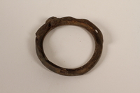
Partial pocket watch casing recovered from Chelmno killing center
Object
Partial pocket watch casing, likely recovered from a temporary pit furnace at Chelmno killing center in German-occupied Poland, during an archaeological excavation in 1986 and 1987. Killing operations at Chelmno commenced on December 8, 1941. Prisoners were taken to a camp at a manor house (Schlosslager) in the village to undress and relinquish their valuables. They were then loaded into a gas van where they were killed. The van was then driven 2.5 miles northwest of the village to a camp in the Rzuchowski forest (Waldlager), where the bodies were dumped into mass graves. The large number of corpses created a threat of disease and discovery by Allied forces, so the bodies were exhumed and burned in seven primitive pit furnaces. In the fall of 1942, the furnaces were replaced with two open-air crematoria consisting of concrete foundations topped by a grate of train rails. In March 1943, transports to Chelmno stopped, and the manor house and open-air crematoria in the forest were demolished. Deportations to Chelmno resumed from June to July 1944, to facilitate the liquidation of the Łódź ghetto. In this second phase, the entire killing process was carried out in the forest camp (Waldlager), necessitating the construction of new buildings. The Germans abandoned the camp on January 17, 1945, having killed over 172,000 people. The excavations of 1986-87, and later work have identified additional furnaces, crematoria, and mass graves at the site.
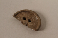
Partial button recovered from Chelmno killing center
Object
Partial button, likely recovered from a temporary pit furnace at Chelmno killing center in German-occupied Poland, during an archaeological excavation in 1986 and 1987. Killing operations at Chelmno commenced on December 8, 1941. Prisoners were taken to a camp at a manor house (Schlosslager) in the village to undress and relinquish their valuables. They were then loaded into a gas van where they were killed. The van was then driven 2.5 miles northwest of the village to a camp in the Rzuchowski forest (Waldlager), where the bodies were dumped into mass graves. The large number of corpses created a threat of disease and discovery by Allied forces, so the bodies were exhumed and burned in seven primitive pit furnaces. In the fall of 1942, the furnaces were replaced with two open-air crematoria consisting of concrete foundations topped by a grate of train rails. In March 1943, transports to Chelmno stopped, and the manor house and open-air crematoria in the forest were demolished. Deportations to Chelmno resumed from June to July 1944, to facilitate the liquidation of the Łódź ghetto. In this second phase, the entire killing process was carried out in the forest camp (Waldlager), necessitating the construction of new buildings. The Germans abandoned the camp on January 17, 1945, having killed over 172,000 people. The excavations of 1986-87, and later work have identified additional furnaces, crematoria, and mass graves at the site.
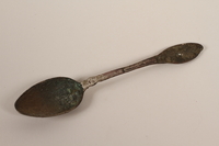
Metal teaspoon recovered from Chelmno killing center
Object
Metal teaspoon, likely recovered from a temporary pit furnace at Chelmno killing center in German-occupied Poland, during an archaeological excavation in 1986 and 1987. Killing operations at Chelmno commenced on December 8, 1941. Prisoners were taken to a camp at a manor house (Schlosslager) in the village to undress and relinquish their valuables. They were then loaded into a gas van where they were killed. The van was then driven 2.5 miles northwest of the village to a camp in the Rzuchowski forest (Waldlager), where the bodies were dumped into mass graves. The large number of corpses created a threat of disease and discovery by Allied forces, so the bodies were exhumed and burned in seven primitive pit furnaces. In the fall of 1942, the furnaces were replaced with two open-air crematoria consisting of concrete foundations topped by a grate of train rails. In March 1943, transports to Chelmno stopped, and the manor house and open-air crematoria in the forest were demolished. Deportations to Chelmno resumed from June to July 1944, to facilitate the liquidation of the Łódź ghetto. In this second phase, the entire killing process was carried out in the forest camp (Waldlager), necessitating the construction of new buildings. The Germans abandoned the camp on January 17, 1945, having killed over 172,000 people. The excavations of 1986-87, and later work have identified additional furnaces, crematoria, and mass graves at the site.
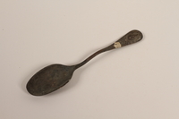
Metal tablespoon recovered from Chelmno killing center
Object
Metal tablespoon, likely recovered from a temporary pit furnace at Chelmno killing center in German-occupied Poland, during an archaeological excavation in 1986 and 1987. Killing operations at Chelmno commenced on December 8, 1941. Prisoners were taken to a camp at a manor house (Schlosslager) in the village to undress and relinquish their valuables. They were then loaded into a gas van where they were killed. The van was then driven 2.5 miles northwest of the village to a camp in the Rzuchowski forest (Waldlager), where the bodies were dumped into mass graves. The large number of corpses created a threat of disease and discovery by Allied forces, so the bodies were exhumed and burned in seven primitive pit furnaces. In the fall of 1942, the furnaces were replaced with two open-air crematoria consisting of concrete foundations topped by a grate of train rails. In March 1943, transports to Chelmno stopped, and the manor house and open-air crematoria in the forest were demolished. Deportations to Chelmno resumed from June to July 1944, to facilitate the liquidation of the Łódź ghetto. In this second phase, the entire killing process was carried out in the forest camp (Waldlager), necessitating the construction of new buildings. The Germans abandoned the camp on January 17, 1945, having killed over 172,000 people. The excavations of 1986-87, and later work have identified additional furnaces, crematoria, and mass graves at the site.
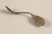
Bent, rusted teaspoon recovered from Chelmno killing center
Object
Metal teaspoon, likely recovered from a temporary pit furnace at Chelmno killing center in German-occupied Poland, during an archaeological excavation in 1986 and 1987. Killing operations at Chelmno commenced on December 8, 1941. Prisoners were taken to a camp at a manor house (Schlosslager) in the village to undress and relinquish their valuables. They were then loaded into a gas van where they were killed. The van was then driven 2.5 miles northwest of the village to a camp in the Rzuchowski forest (Waldlager), where the bodies were dumped into mass graves. The large number of corpses created a threat of disease and discovery by Allied forces, so the bodies were exhumed and burned in seven primitive pit furnaces. In the fall of 1942, the furnaces were replaced with two open-air crematoria consisting of concrete foundations topped by a grate of train rails. In March 1943, transports to Chelmno stopped, and the manor house and open-air crematoria in the forest were demolished. Deportations to Chelmno resumed from June to July 1944, to facilitate the liquidation of the Łódź ghetto. In this second phase, the entire killing process was carried out in the forest camp (Waldlager), necessitating the construction of new buildings. The Germans abandoned the camp on January 17, 1945, having killed over 172,000 people. The excavations of 1986-87, and later work have identified additional furnaces, crematoria, and mass graves at the site.
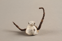
Porcelain and metal bottle stopper recovered from Chelmno killing center
Object
Porcelain bottle stopper, likely recovered from a temporary pit furnace at Chelmno killing center in German-occupied Poland, during an archaeological excavation in 1986 and 1987. Killing operations at Chelmno commenced on December 8, 1941. Prisoners were taken to a camp at a manor house (Schlosslager) in the village to undress and relinquish their valuables. They were then loaded into a gas van where they were killed. The van was then driven 2.5 miles northwest of the village to a camp in the Rzuchowski forest (Waldlager), where the bodies were dumped into mass graves. The large number of corpses created a threat of disease and discovery by Allied forces, so the bodies were exhumed and burned in seven primitive pit furnaces. In the fall of 1942, the furnaces were replaced with two open-air crematoria consisting of concrete foundations topped by a grate of train rails. In March 1943, transports to Chelmno stopped, and the manor house and open-air crematoria in the forest were demolished. Deportations to Chelmno resumed from June to July 1944, to facilitate the liquidation of the Łódź ghetto. In this second phase, the entire killing process was carried out in the forest camp (Waldlager), necessitating the construction of new buildings. The Germans abandoned the camp on January 17, 1945, having killed over 172,000 people. The excavations of 1986-87, and later work have identified additional furnaces, crematoria, and mass graves at the site.
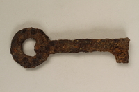
Small metal key recovered from Chelmno killing center
Object
Metal key, likely recovered from a temporary pit furnace at Chelmno killing center in German-occupied Poland, during an archaeological excavation in 1986 and 1987. Killing operations at Chelmno commenced on December 8, 1941. Prisoners were taken to a camp at a manor house (Schlosslager) in the village to undress and relinquish their valuables. They were then loaded into a gas van where they were killed. The van was then driven 2.5 miles northwest of the village to a camp in the Rzuchowski forest (Waldlager), where the bodies were dumped into mass graves. The large number of corpses created a threat of disease and discovery by Allied forces, so the bodies were exhumed and burned in seven primitive pit furnaces. In the fall of 1942, the furnaces were replaced with two open-air crematoria consisting of concrete foundations topped by a grate of train rails. In March 1943, transports to Chelmno stopped, and the manor house and open-air crematoria in the forest were demolished. Deportations to Chelmno resumed from June to July 1944, to facilitate the liquidation of the Łódź ghetto. In this second phase, the entire killing process was carried out in the forest camp (Waldlager), necessitating the construction of new buildings. The Germans abandoned the camp on January 17, 1945, having killed over 172,000 people. The excavations of 1986-87, and later work have identified additional furnaces, crematoria, and mass graves at the site.
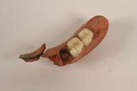
Partial lower plate of a denture with two molars recovered from Chelmno killing center
Object
Fragment of a lower denture, likely recovered from a temporary pit furnace at Chelmno killing center in German-occupied Poland, during an archaeological excavation in 1986 and 1987. Killing operations at Chelmno commenced on December 8, 1941. Prisoners were taken to a camp at a manor house (Schlosslager) in the village to undress and relinquish their valuables. They were then loaded into a gas van where they were killed. The van was then driven 2.5 miles northwest of the village to a camp in the Rzuchowski forest (Waldlager), where the bodies were dumped into mass graves. The large number of corpses created a threat of disease and discovery by Allied forces, so the bodies were exhumed and burned in seven primitive pit furnaces. In the fall of 1942, the furnaces were replaced with two open-air crematoria consisting of concrete foundations topped by a grate of train rails. In March 1943, transports to Chelmno stopped, and the manor house and open-air crematoria in the forest were demolished. Deportations to Chelmno resumed from June to July 1944, to facilitate the liquidation of the Łódź ghetto. In this second phase, the entire killing process was carried out in the forest camp (Waldlager), necessitating the construction of new buildings. The Germans abandoned the camp on January 17, 1945, having killed over 172,000 people. The excavations of 1986-87, and later work have identified additional furnaces, crematoria, and mass graves at the site.
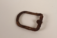
Metal buckle frame recovered from Chelmno killing center
Object
Metal buckle frame, likely recovered from a temporary pit furnace at Chelmno killing center in German-occupied Poland, during an archaeological excavation in 1986 and 1987. Killing operations at Chelmno commenced on December 8, 1941. Prisoners were taken to a camp at a manor house (Schlosslager) in the village to undress and relinquish their valuables. They were then loaded into a gas van where they were killed. The van was then driven 2.5 miles northwest of the village to a camp in the Rzuchowski forest (Waldlager), where the bodies were dumped into mass graves. The large number of corpses created a threat of disease and discovery by Allied forces, so the bodies were exhumed and burned in seven primitive pit furnaces. In the fall of 1942, the furnaces were replaced with two open-air crematoria consisting of concrete foundations topped by a grate of train rails. In March 1943, transports to Chelmno stopped, and the manor house and open-air crematoria in the forest were demolished. Deportations to Chelmno resumed from June to July 1944, to facilitate the liquidation of the Łódź ghetto. In this second phase, the entire killing process was carried out in the forest camp (Waldlager), necessitating the construction of new buildings. The Germans abandoned the camp on January 17, 1945, having killed over 172,000 people. The excavations of 1986-87, and later work have identified additional furnaces, crematoria, and mass graves at the site.
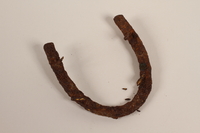
Metal horseshoe-shaped heel plate recovered from Chelmno killing center
Object
Metal heel plate, likely recovered from a temporary pit furnace at Chelmno killing center in German-occupied Poland, during an archaeological excavation in 1986 and 1987. Killing operations at Chelmno commenced on December 8, 1941. Prisoners were taken to a camp at a manor house (Schlosslager) in the village to undress and relinquish their valuables. They were then loaded into a gas van where they were killed. The van was then driven 2.5 miles northwest of the village to a camp in the Rzuchowski forest (Waldlager), where the bodies were dumped into mass graves. The large number of corpses created a threat of disease and discovery by Allied forces, so the bodies were exhumed and burned in seven primitive pit furnaces. In the fall of 1942, the furnaces were replaced with two open-air crematoria consisting of concrete foundations topped by a grate of train rails. In March 1943, transports to Chelmno stopped, and the manor house and open-air crematoria in the forest were demolished. Deportations to Chelmno resumed from June to July 1944, to facilitate the liquidation of the Łódź ghetto. In this second phase, the entire killing process was carried out in the forest camp (Waldlager), necessitating the construction of new buildings. The Germans abandoned the camp on January 17, 1945, having killed over 172,000 people. The excavations of 1986-87, and later work have identified additional furnaces, crematoria, and mass graves at the site.
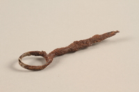
Small scissors in two pieces, recovered from Chelmno killing center
Object
Metal scissors, likely recovered from a temporary pit furnace at Chelmno killing center in German-occupied Poland, during an archaeological excavation in 1986 and 1987. Killing operations at Chelmno commenced on December 8, 1941. Prisoners were taken to a camp at a manor house (Schlosslager) in the village to undress and relinquish their valuables. They were then loaded into a gas van where they were killed. The van was then driven 2.5 miles northwest of the village to a camp in the Rzuchowski forest (Waldlager), where the bodies were dumped into mass graves. The large number of corpses created a threat of disease and discovery by Allied forces, so the bodies were exhumed and burned in seven primitive pit furnaces. In the fall of 1942, the furnaces were replaced with two open-air crematoria consisting of concrete foundations topped by a grate of train rails. In March 1943, transports to Chelmno stopped, and the manor house and open-air crematoria in the forest were demolished. Deportations to Chelmno resumed from June to July 1944, to facilitate the liquidation of the Łódź ghetto. In this second phase, the entire killing process was carried out in the forest camp (Waldlager), necessitating the construction of new buildings. The Germans abandoned the camp on January 17, 1945, having killed over 172,000 people. The excavations of 1986-87, and later work have identified additional furnaces, crematoria, and mass graves at the site.
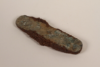
Rusted pocketknife recovered from Chelmno killing center
Object
Pocketknife, likely recovered from a temporary pit furnace at Chelmno killing center in German-occupied Poland, during an archaeological excavation in 1986 and 1987. Killing operations at Chelmno commenced on December 8, 1941. Prisoners were taken to a camp at a manor house (Schlosslager) in the village to undress and relinquish their valuables. They were then loaded into a gas van where they were killed. The van was then driven 2.5 miles northwest of the village to a camp in the Rzuchowski forest (Waldlager), where the bodies were dumped into mass graves. The large number of corpses created a threat of disease and discovery by Allied forces, so the bodies were exhumed and burned in seven primitive pit furnaces. In the fall of 1942, the furnaces were replaced with two open-air crematoria consisting of concrete foundations topped by a grate of train rails. In March 1943, transports to Chelmno stopped, and the manor house and open-air crematoria in the forest were demolished. Deportations to Chelmno resumed from June to July 1944, to facilitate the liquidation of the Łódź ghetto. In this second phase, the entire killing process was carried out in the forest camp (Waldlager), necessitating the construction of new buildings. The Germans abandoned the camp on January 17, 1945, having killed over 172,000 people. The excavations of 1986-87, and later work have identified additional furnaces, crematoria, and mass graves at the site.
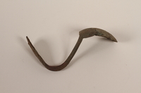
Metal teaspoon recovered from Chelmno killing center
Object
Metal teaspoon, likely recovered from a temporary pit furnace at Chelmno killing center in German-occupied Poland, during an archaeological excavation in 1986 and 1987. Killing operations at Chelmno commenced on December 8, 1941. Prisoners were taken to a camp at a manor house (Schlosslager) in the village to undress and relinquish their valuables. They were then loaded into a gas van where they were killed. The van was then driven 2.5 miles northwest of the village to a camp in the Rzuchowski forest (Waldlager), where the bodies were dumped into mass graves. The large number of corpses created a threat of disease and discovery by Allied forces, so the bodies were exhumed and burned in seven primitive pit furnaces. In the fall of 1942, the furnaces were replaced with two open-air crematoria consisting of concrete foundations topped by a grate of train rails. In March 1943, transports to Chelmno stopped, and the manor house and open-air crematoria in the forest were demolished. Deportations to Chelmno resumed from June to July 1944, to facilitate the liquidation of the Łódź ghetto. In this second phase, the entire killing process was carried out in the forest camp (Waldlager), necessitating the construction of new buildings. The Germans abandoned the camp on January 17, 1945, having killed over 172,000 people. The excavations of 1986-87, and later work have identified additional furnaces, crematoria, and mass graves at the site.
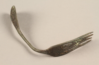
Bent metal fork recovered from Chelmno killing center
Object
Metal fork, likely recovered from a temporary pit furnace at Chelmno killing center in German-occupied Poland, during an archaeological excavation in 1986 and 1987. Killing operations at Chelmno commenced on December 8, 1941. Prisoners were taken to a camp at a manor house (Schlosslager) in the village to undress and relinquish their valuables. They were then loaded into a gas van where they were killed. The van was then driven 2.5 miles northwest of the village to a camp in the Rzuchowski forest (Waldlager), where the bodies were dumped into mass graves. The large number of corpses created a threat of disease and discovery by Allied forces, so the bodies were exhumed and burned in seven primitive pit furnaces. In the fall of 1942, the furnaces were replaced with two open-air crematoria consisting of concrete foundations topped by a grate of train rails. In March 1943, transports to Chelmno stopped, and the manor house and open-air crematoria in the forest were demolished. Deportations to Chelmno resumed from June to July 1944, to facilitate the liquidation of the Łódź ghetto. In this second phase, the entire killing process was carried out in the forest camp (Waldlager), necessitating the construction of new buildings. The Germans abandoned the camp on January 17, 1945, having killed over 172,000 people. The excavations of 1986-87, and later work have identified additional furnaces, crematoria, and mass graves at the site.
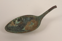
Metal tablespoon fragment recovered from Chelmno killing center
Object
Metal tablespoon, likely recovered from a temporary pit furnace at Chelmno killing center in German-occupied Poland, during an archaeological excavation in 1986 and 1987. Killing operations at Chelmno commenced on December 8, 1941. Prisoners were taken to a camp at a manor house (Schlosslager) in the village to undress and relinquish their valuables. They were then loaded into a gas van where they were killed. The van was then driven 2.5 miles northwest of the village to a camp in the Rzuchowski forest (Waldlager), where the bodies were dumped into mass graves. The large number of corpses created a threat of disease and discovery by Allied forces, so the bodies were exhumed and burned in seven primitive pit furnaces. In the fall of 1942, the furnaces were replaced with two open-air crematoria consisting of concrete foundations topped by a grate of train rails. In March 1943, transports to Chelmno stopped, and the manor house and open-air crematoria in the forest were demolished. Deportations to Chelmno resumed from June to July 1944, to facilitate the liquidation of the Łódź ghetto. In this second phase, the entire killing process was carried out in the forest camp (Waldlager), necessitating the construction of new buildings. The Germans abandoned the camp on January 17, 1945, having killed over 172,000 people. The excavations of 1986-87, and later work have identified additional furnaces, crematoria, and mass graves at the site.
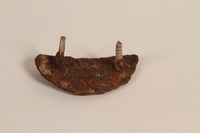
Rusted heel plate with a screw and nail recovered from Chelmno killing center
Object
Metal heel plate, likely recovered from a temporary pit furnace at Chelmno killing center in German-occupied Poland, during an archaeological excavation in 1986 and 1987. Killing operations at Chelmno commenced on December 8, 1941. Prisoners were taken to a camp at a manor house (Schlosslager) in the village to undress and relinquish their valuables. They were then loaded into a gas van where they were killed. The van was then driven 2.5 miles northwest of the village to a camp in the Rzuchowski forest (Waldlager), where the bodies were dumped into mass graves. The large number of corpses created a threat of disease and discovery by Allied forces, so the bodies were exhumed and burned in seven primitive pit furnaces. In the fall of 1942, the furnaces were replaced with two open-air crematoria consisting of concrete foundations topped by a grate of train rails. In March 1943, transports to Chelmno stopped, and the manor house and open-air crematoria in the forest were demolished. Deportations to Chelmno resumed from June to July 1944, to facilitate the liquidation of the Łódź ghetto. In this second phase, the entire killing process was carried out in the forest camp (Waldlager), necessitating the construction of new buildings. The Germans abandoned the camp on January 17, 1945, having killed over 172,000 people. The excavations of 1986-87, and later work have identified additional furnaces, crematoria, and mass graves at the site.
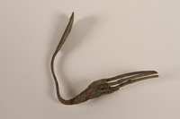
Metal fork recovered from Chelmno killing center
Object
Metal fork, likely recovered from a temporary pit furnace at Chelmno killing center in German-occupied Poland, during an archaeological excavation in 1986 and 1987. Killing operations at Chelmno commenced on December 8, 1941. Prisoners were taken to a camp at a manor house (Schlosslager) in the village to undress and relinquish their valuables. They were then loaded into a gas van where they were killed. The van was then driven 2.5 miles northwest of the village to a camp in the Rzuchowski forest (Waldlager), where the bodies were dumped into mass graves. The large number of corpses created a threat of disease and discovery by Allied forces, so the bodies were exhumed and burned in seven primitive pit furnaces. In the fall of 1942, the furnaces were replaced with two open-air crematoria consisting of concrete foundations topped by a grate of train rails. In March 1943, transports to Chelmno stopped, and the manor house and open-air crematoria in the forest were demolished. Deportations to Chelmno resumed from June to July 1944, to facilitate the liquidation of the Łódź ghetto. In this second phase, the entire killing process was carried out in the forest camp (Waldlager), necessitating the construction of new buildings. The Germans abandoned the camp on January 17, 1945, having killed over 172,000 people. The excavations of 1986-87, and later work have identified additional furnaces, crematoria, and mass graves at the site.
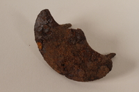
Corroded metal heel plate recovered from Chelmno killing center
Object
Metal heel plate, likely recovered from a temporary pit furnace at Chelmno killing center in German-occupied Poland, during an archaeological excavation in 1986 and 1987. Killing operations at Chelmno commenced on December 8, 1941. Prisoners were taken to a camp at a manor house (Schlosslager) in the village to undress and relinquish their valuables. They were then loaded into a gas van where they were killed. The van was then driven 2.5 miles northwest of the village to a camp in the Rzuchowski forest (Waldlager), where the bodies were dumped into mass graves. The large number of corpses created a threat of disease and discovery by Allied forces, so the bodies were exhumed and burned in seven primitive pit furnaces. In the fall of 1942, the furnaces were replaced with two open-air crematoria consisting of concrete foundations topped by a grate of train rails. In March 1943, transports to Chelmno stopped, and the manor house and open-air crematoria in the forest were demolished. Deportations to Chelmno resumed from June to July 1944, to facilitate the liquidation of the Łódź ghetto. In this second phase, the entire killing process was carried out in the forest camp (Waldlager), necessitating the construction of new buildings. The Germans abandoned the camp on January 17, 1945, having killed over 172,000 people. The excavations of 1986-87, and later work have identified additional furnaces, crematoria, and mass graves at the site.
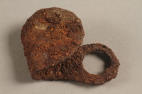
Rusted, bent metal shoehorn recovered from Chelmno killing center
Object
Metal shoehorn, likely recovered from a temporary pit furnace at Chelmno killing center in German-occupied Poland, during an archaeological excavation in 1986 and 1987. Killing operations at Chelmno commenced on December 8, 1941. Prisoners were taken to a camp at a manor house (Schlosslager) in the village to undress and relinquish their valuables. They were then loaded into a gas van where they were killed. The van was then driven 2.5 miles northwest of the village to a camp in the Rzuchowski forest (Waldlager), where the bodies were dumped into mass graves. The large number of corpses created a threat of disease and discovery by Allied forces, so the bodies were exhumed and burned in seven primitive pit furnaces. In the fall of 1942, the furnaces were replaced with two open-air crematoria consisting of concrete foundations topped by a grate of train rails. In March 1943, transports to Chelmno stopped, and the manor house and open-air crematoria in the forest were demolished. Deportations to Chelmno resumed from June to July 1944, to facilitate the liquidation of the Łódź ghetto. In this second phase, the entire killing process was carried out in the forest camp (Waldlager), necessitating the construction of new buildings. The Germans abandoned the camp on January 17, 1945, having killed over 172,000 people. The excavations of 1986-87, and later work have identified additional furnaces, crematoria, and mass graves at the site.
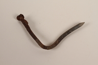
Nail recovered from Chelmno killing center
Object
Metal nail, likely recovered from a temporary pit furnace at Chelmno killing center in German-occupied Poland, during an archaeological excavation in 1986 and 1987. Killing operations at Chelmno commenced on December 8, 1941. Prisoners were taken to a camp at a manor house (Schlosslager) in the village to undress and relinquish their valuables. They were then loaded into a gas van where they were killed. The van was then driven 2.5 miles northwest of the village to a camp in the Rzuchowski forest (Waldlager), where the bodies were dumped into mass graves. The large number of corpses created a threat of disease and discovery by Allied forces, so the bodies were exhumed and burned in seven primitive pit furnaces. In the fall of 1942, the furnaces were replaced with two open-air crematoria consisting of concrete foundations topped by a grate of train rails. In March 1943, transports to Chelmno stopped, and the manor house and open-air crematoria in the forest were demolished. Deportations to Chelmno resumed from June to July 1944, to facilitate the liquidation of the Łódź ghetto. In this second phase, the entire killing process was carried out in the forest camp (Waldlager), necessitating the construction of new buildings. The Germans abandoned the camp on January 17, 1945, having killed over 172,000 people. The excavations of 1986-87, and later work have identified additional furnaces, crematoria, and mass graves at the site.
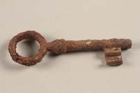
Large, rusted metal key recovered from Chelmno killing center
Object
Metal skeleton key, likely recovered from a temporary pit furnace at Chelmno killing center in German-occupied Poland, during an archaeological excavation in 1986 and 1987. Killing operations at Chelmno commenced on December 8, 1941. Prisoners were taken to a camp at a manor house (Schlosslager) in the village to undress and relinquish their valuables. They were then loaded into a gas van where they were killed. The van was then driven 2.5 miles northwest of the village to a camp in the Rzuchowski forest (Waldlager), where the bodies were dumped into mass graves. The large number of corpses created a threat of disease and discovery by Allied forces, so the bodies were exhumed and burned in seven primitive pit furnaces. In the fall of 1942, the furnaces were replaced with two open-air crematoria consisting of concrete foundations topped by a grate of train rails. In March 1943, transports to Chelmno stopped, and the manor house and open-air crematoria in the forest were demolished. Deportations to Chelmno resumed from June to July 1944, to facilitate the liquidation of the Łódź ghetto. In this second phase, the entire killing process was carried out in the forest camp (Waldlager), necessitating the construction of new buildings. The Germans abandoned the camp on January 17, 1945, having killed over 172,000 people. The excavations of 1986-87, and later work have identified additional furnaces, crematoria, and mass graves at the site.
Four eyeglass lenses recovered from Chelmno killing center
Object
Four eyeglass lenses, likely recovered from a temporary pit furnace at Chelmno killing center in German-occupied Poland, during an archaeological excavation in 1986 and 1987. Killing operations at Chelmno commenced on December 8, 1941. Prisoners were taken to a camp at a manor house (Schlosslager) in the village to undress and relinquish their valuables. They were then loaded into a gas van where they were killed. The van was then driven 2.5 miles northwest of the village to a camp in the Rzuchowski forest (Waldlager), where the bodies were dumped into mass graves. The large number of corpses created a threat of disease and discovery by Allied forces, so the bodies were exhumed and burned in seven primitive pit furnaces. In the fall of 1942, the furnaces were replaced with two open-air crematoria consisting of concrete foundations topped by a grate of train rails. In March 1943, transports to Chelmno stopped, and the manor house and open-air crematoria in the forest were demolished. Deportations to Chelmno resumed from June to July 1944, to facilitate the liquidation of the Łódź ghetto. In this second phase, the entire killing process was carried out in the forest camp (Waldlager), necessitating the construction of new buildings. The Germans abandoned the camp on January 17, 1945, having killed over 172,000 people. The excavations of 1986-87, and later work have identified additional furnaces, crematoria, and mass graves at the site.
Concrete remnants excavated from the crematorium at Chelmno killing center
Object
Concrete fragments recovered from a crematorium foundation at Chelmno killing center in German-occupied Poland, during an archaeological excavation in 1986 and 1987. Killing operations at Chelmno commenced on December 8, 1941. Prisoners were taken to a camp at a manor house (Schlosslager) in the village to undress and relinquish their valuables. They were then loaded into a gas van where they were killed. The van was then driven 2.5 miles northwest of the village to a camp in the Rzuchowski forest (Waldlager), where the bodies were dumped into mass graves. The large number of corpses created a threat of disease and discovery by Allied forces, so the bodies were exhumed and burned in seven primitive pit furnaces. In the fall of 1942, the furnaces were replaced with two open-air crematoria consisting of concrete foundations topped by a grate of train rails. The construction of the crematoria was overseen by an SS officer named Johannes Runge. In March 1943, transports to Chelmno stopped, and the manor house and open-air crematoria in the forest were demolished. Deportations to Chelmno resumed from June to July 1944 to facilitate the liquidation of the Łódź ghetto. In this second phase, the entire killing process was carried out in the forest camp, necessitating the construction of new buildings. The Germans abandoned the camp on January 17, 1945, having killed over 172,000 people. The excavations of 1986-87, and later work have identified additional furnaces, crematoria, and mass graves at the site.
