Overview
- Brief Narrative
- Propaganda map of Northern and Eastern Europe distributed by the National Propaganda Office of the Nazi Party showing previous German territorial boundaries compared with their military expansion as of 1941. The map shows German occupied territory in red overlaid with the German borders before and during WWI. The poster was published by the National Propaganda Office, which controlled the film, radio, theater, and press and chose what information to distribute to the public. By 1941, Germany had made alliances with Italy, Finland, Bulgaria, and Hungary and had conquered France, Norway, and every European nation in Eastern Europe. On June 22, 1941, Germany, with the support of its allies, invaded the Soviet Union, and by September, they had advanced past the city of Smolensk. The poster implies that information about German defeats from the Soviet Union and Britain are lies and presents Germany’s territorial expansion throughout Eastern Europe as evidence.
- Title
- Unser Vormarsch im Osten Tatsachen gegen Lügen
- Alternate Title
- Our advance in the East, Facts Against Lies
- Date
-
manufacture:
approximately 1941 September
- Geography
-
distribution:
Germany
manufacture: Dresden (Germany)
- Credit Line
- United States Holocaust Memorial Museum Collection, Gift of David and Lucinda Pollack
- Markings
- front, top and bottom, printed, black ink : Unser Vormarsch im Osten / Tatsachen gegen Lügen [Our advance in the East, Facts Against Lies]
front, top right, printed, black and red ink : Moskau und London logen das / Blaue vom Himmel herunter über / Sowjet-Erfolge und deutsche / Niederlagen oder wenigstens / Stillstannd unserer Operationen. / Hier unsere Antwort: / so standen wir 1915 sechs Wochen / nach Beginn der Frühjarsoffensive / so standen wir 1917 bei Beginn der / Waffenstillstandsverhandlungen / und so stehen wir diesmal / sechs Wochen nach Beginn / des Ostfeldzuges / Deutschland bis 1914 / DeutschesReichsgebiet, Gebiet derver / -bündeten Staaten u. die besetzten Gebiete / Neutrale Staaten / Sowjet-Union [Moscow and London lied blue from the sky about Soviet successes and German defeats, or at least the silence of our operations. / Here is our answer: / In 1915 we were six weeks after the beginning of the spring offensive / So we stood in 1917 at the beginning of the ceasefire negotiations / And so we stand this time six weeks after the beginning of the Eastern campaign /
Germany until 1914 / German Reich territory, the territory of the allied states and occupied territories / Neutral states / Soviet Union
front, bottom left, printed, black ink : Plakat Nr. 16 der R.P.L. [Poster No. 16 of Reichspropaganda-Leitung (Reich Propaganda Line)]
front, bottom right, printed, black ink : Tiefdruck Dr. Güntz-Druck Dresden [printer Dr. Güntz-Druck Dresden] - Signature
- bottom right, within image, printed, black ink : FM
- Contributor
-
Printer:
Dr. Güntz-Druck
Publisher: Reichspropagandaleitung der N.S.D.A.P.
Physical Details
- Language
- German
- Classification
-
Posters
- Category
-
Nazi propaganda
- Object Type
-
Posters, German (lcsh)
- Genre/Form
- Maps.
- Physical Description
- Offset Lithographic poster printed on faded white lightweight paper depicting a colored map of Eastern and Northern Europe. The map shows the German boundaries in 1914, 1915, and 1917 with a black dashed line, a dotted line, and a bold black line in comparison with the German Reich and its allies in red and German territorial conquests in red with light horizontal white lines. The Soviet Union is colored in green and Sweden and Switzerland are in yellow. Bodies of water are depicted in dark blue. The map also shows the names and former boundaries of the occupied nations in light black lines and Europe’s capital cities with large black dots. A large, rectangular white legend is in the top right corner. The poster has a white border with a large black text title across the top and bottom. The top left side has some minor water damage, small losses, and wrinkles along the edge. There is a horizontal yellow line across the bottom.
- Dimensions
- overall: Height: 33.000 inches (83.82 cm) | Width: 23.250 inches (59.055 cm)
- Materials
- overall : paper, ink, pencil
- Inscription
- backside, bottom right, handwritten, pencil : 11552
Rights & Restrictions
- Conditions on Access
- No restrictions on access
- Conditions on Use
- No restrictions on use
Keywords & Subjects
- Topical Term
- World War, 1939-1945. World War, 1939-1945--Propaganda. Nazi Propaganda--Germany. Germany--History--1933-1945--Maps. Nazi Propaganda
- Geographic Name
- Dresden (Germany)
- Corporate Name
- Reichspropagandaleitung der N.S.D.A.P.
Administrative Notes
- Legal Status
- Permanent Collection
- Provenance
- The poster was donated to the United States Holocaust Memorial Museum in 2018 by David and Lucinda Pollack.
- Record last modified:
- 2023-06-08 08:56:31
- This page:
- https://collections.ushmm.org/search/catalog/irn614062
Download & Licensing
In-Person Research
- By Appointment
- Request 21 Days in Advance of Visit
- Plan a Research Visit
- Request to See This Object
Contact Us
Also in David and Lucinda Pollack collection
The collection consists of American, French, Hungarian, and German propaganda, war bonds, recruitment, and election posters produced during World War II.
Date: approximately 1940-approximately 1945
US Buy War Bonds poster
Object
US 5th war loan poster
Object
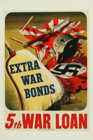
Poster for the 5th War Loan campaign with a broom sweeping Nazi emblems. The campaign for the 5th War Loan subscription took place from June 12 - July 8, 1944. There were 8 war loan drives from 1942 to 1945. By the end of the war, 85 million Americans had purchased 185.7 billion dollars of bonds.
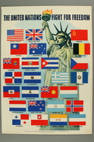
US poster depicting the Statue of Liberty and flags of the Allied Nations
Object
US and Allied Nations propaganda poster with an image of the Statue of Liberty and Allied flags. It was issued by the Office of War Information as a symbol of the unity of the Allied forces against their common enemies, the Axis powers. On January 1, 1942, the US, Great Britain, Soviet Union, and China signed the United Nations Declaration, joined the next day by 22 other nations. The signatory governments pledged to exert the maximum war effort and not to make a separate peace. The United Nations was founded 3 years later. The need to manage the war on the Home Front led to the establishment of the OWI in June 1942. This office controlled the design and distribution of war information to the American public in posters, photographs, radio shows, and films. They commissioned work from leading artists and the posers were distributed to retailers for display.
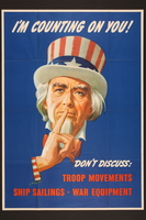
Security of War Information Campaign poster of Uncle Sam with his finger to his lips asking for silence
Object
Security of War Information Campaign poster featuring the Uncle Sam icon with his finger to his mouth in a hushing gesture. This modification of the Uncle Sam image, created by Montgomery Flagg for World War I recruitment posters, was designed by Leon Helguera, a Mexican artist who immigrated to America in 1916. The Security of War Information Campaign, also known as the “hush-hush campaign,” was a cooperative project by the Army, Navy, and FBI. The project was undertaken by the Office of War Information (OWI) with the oversight of a Security Committee, which included representatives from the OWI, the Army, Navy, FBI, and other agencies. The campaign focused on educating the public about the need for discretion in their communication to prevent information from being leaked to the enemy. The need to manage information about the war on the home front led to the establishment of the OWI in June 1942. This office controlled the design and distribution of war information to the American public in print, radio, and film media, and commissioned work from leading artists. The “careless talk series” originated in 1940 in Great Britain. It highlighted the many ways that careless talk could leak sensitive information that enemies would use to kill soldiers, sink ships, and undermine the war effort.
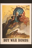
US buy war bonds poster
Object
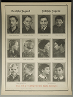
Nazi racial science poster
Object
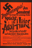
Nazi Party election poster
Object
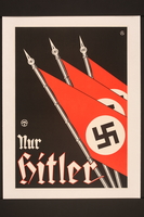
Only Hitler poster
Object

US war propaganda poster
Object
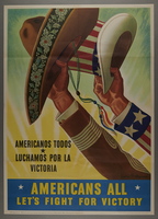
Bilingual poster encouraging wartime unity of Mexico and America and all American citizens regardless of nationality
Object
“Americans All” bilingual poster featuring two hats, one symbolizing Mexico and the other symbolizing America, raised up in unison. The poster was designed to promote unity between America’s multi-ethnic demographics and the nations of the Western Hemisphere during wartime. The poster was designed by Leon Helguera, a Mexican artist who immigrated to America in 1916, and was commissioned by the Office of Wartime Information (OWI). The OWI was established in 1942, and managed information about the war on the home front. This office controlled the design and distribution of war information to the American public in print, radio, and film media, and commissioned work from leading artists. The “Americans All” slogan expressed a call for unity among Americans of different backgrounds and for solidarity between the nations of the Western Hemisphere in the face of the Axis threat. In 1942, racial tensions in the Southwestern United States were at a critical point following the Sleepy Lagoon Murder in August in Los Angeles, California. Twenty-two Mexican Americans were arrested and tried without due process for the crime, causing riots in Los Angeles in 1943.The Axis powers inflamed this division with anti-American radio broadcasts in Latin America to sway public opinion. To ease the racial unrest, the OWI introduced a campaign that utilized patriotic images, with slogans in Spanish and English, to appeal to Americans of Mexican descent. Despite the hostility, Mexican Americans provided sizable contributions to the war effort with over 17,000 working in Los Angeles shipyards, airfields, and armament factories.
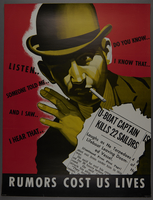
US careless talk kills sailors poster
Object
Poster depicting a man with a cigarette with his hand to his ear; behind him are phrases he is listening to, including, "Do you know...", "I know that...", "Someone told me...", and "I hear that..." Under the man's face is an illustration of a news clipping with the headline, "U-Boat Captain Kills 22 Sailors."
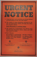
US careless talk poster on Pacific troop locations
Object
Rectangular poster with black lettering on a red background urging readers not to discuss the location or movements of men, ships and materials within, to or from Asiatic-Pacific areas.
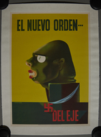
US anti-Axis propaganda poster
Object
US propaganda poster published by El Coordinator de Asuntos Interamericanos.
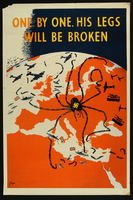
Poster, One by One, His Legs Will be Broken
Object
Poster created by artist Kimon Evan Marengo (aka Kem); dated 1941; in English.
German Labor Front poster
Object
German Labor Front poster
Object
German Labor Front poster
Object
German Labor Front poster
Object
German Labor Front poster
Object
German Labor Front poster
Object
German Labor Front poster
Object
German Labor Front poster
Object
German Labor Front poster
Object
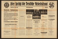
German Labor Front poster
Object
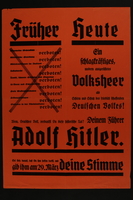
Früher Heute Poster
Object
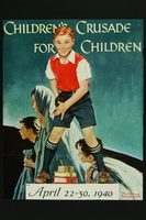
Children's Crusade for Children advertisement poster
Object
Poster designed by Norman Rockwell advertising for the Children’s Crusade for Children penny sharing relief drive to provide assistance for the war stricken children of Europe. The program was organized during the winter of 1939-1940 under the leadership of Marion G. Canby and Dorothy Canfield Fisher. The program was supported by First Lady Eleanor Roosevelt and special tin collection cans were decorated with the design featured on this poster and distributed to schools around the country. The children were instructed to give as many pennies as they were years old. The principal or a delegated student would then retrieve the money from the can and mail it to a collection center in Kansas or Vermont depending on the school’s location. The crusade had two purposes: to make American children aware of the blessings of living in a democratic country, and to give these children an opportunity to express their sympathy for the plight of war-stricken children in other lands. The nationwide collection ran from April 23 to April 30, 1940.
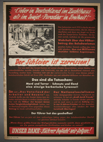
German anti-Soviet poster
Object
Red, black and white poster with photograph of women looking at corpses; headline above: Lieber in Deutschland im Zuchthaus als im Sowjet 'paradies' in Freheit!

Poster encouraging the buying of war bonds
Object
Poster with image of Hitler being punched in the chin, swastikas on his eyes and "2nd War Loan" on the fist; "Right in Der Fuerher's Face!/Invest Now...Buy More Bonds/Make Your Dollars Fight"

Poster, "They're still giving/Are You? Give to your Community War Fund"
Object
Poster with image of soldier standing with helmet in hand, head bowed, in front of three graves marked with two crosses and one Star of David; "They're still giving/Are You? Give to your Community War Fund"; artist John Falter.
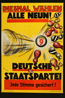
1932 election poster
Object
1932 election poster with image of a ball reading "Liste 9" knocking over bowling pins representing different countries. Yellow background with text in red and black reading "Diesmal Wählen/Alle Neun!/Deutsche/Staatspartei/Jede Stimme gesichert!", dated 1932. Artist: Günther Stüdemann.
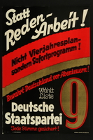
1932 election poster
Object
1932 election poster with image of a large number "9" in lower right corner. Black background with text reading "Statt/Reden-/Arbeit!/Nicht Vierjahresplan-/sondern Sofortprogramm! Bewahrt Deutschland vor Abenteurn!...." Poster is dated 1932. Artist: Günther Stüdemann.
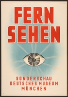
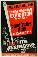
1937 exhibition poster
Object
1937 poster from an exhibit on television at the Deutsches Museum in Munich, titled "Fern Sehen/Sonderschau Deutsches Museum München." The poster depicts a single eye radiating light beams against a light blue background. Artist: Eugene Maria Cordier.
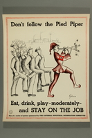
Poster sponsored by the National Industrial Information Committee
Object
Poster: Image of Hitler dressed as the Pied Piper leading workers; captioned at top: “Don’t follow the Pied Piper”; at bottom: “Eat, drink, play-moderately- / and STAY ON THE JOB”; one of a series of posters sponsored by The National Industrial Information Committee”; signed in lower right by artist “Golovin”; in English; dated 1941-1945
Poster sponsored by the National Industrial Information Committee
Object
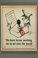
Poster: Image of Hitler reading a “US Newspaper” and speaking into a microphone; captioned beneath: ““We have forces working / for us all over the world” / Adolf Hitler”; one of a series of posters sponsored by The National Industrial Information Committee”; signed in lower right by artist “Golovin”; in English; dated 1941-1945
Poster
Object
Poster
Object
Poster
Object
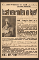
Poster
Object
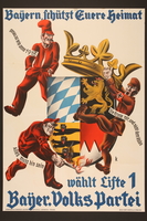
Poster
Object
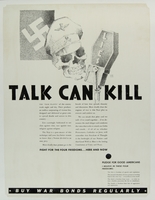
American propaganda poster
Object
American propaganda poster: Black and white image of Nazi flag, skull wearing cap with SS insignia and a microphone marked “LIES”; caption/titled “TALK CAN KILL,” multiple paragraphs of text in two columns, a Pledge for Good Americans and “Buy War Bonds Regularly” across the bottom; in English

American propaganda poster
Object
American propaganda poster: recto: color image captioned “Put this snake where he belongs.” across top and “Don’t mix scrap metals. – There’s a separate box for each kind of scrap." at bottom; images of snake made from collage of items with German cap, mustache and hair to make it look like Hitler; verso: black and white photo of Douglas C-54 Combat-Transport plane; in English
Poster, Association Nationale des Victimes du Nazisme
Object
Poster: “Association Nationale des Victimes du Nazisme”; red background, image of black SS runes in center with woman in blue dress with one arm draped over the left S, head back, and other hand on the same S, with baby laying on the ground at her feet with its arms spread open; dated 1945; Paris, France; in French
Poster published by Office of War Information in 1943
Object
Poster: “Ten years ago: / THE NAZIS BURNED THESE BOOKS / …but free Americans / CAN STILL READ THEM”; black and white photographic image of pile of burning books in foreground with uniformed men watching, and other men and women in background doing raising one arm in Nazi salute; published by Office of War Information, No. 66, Washington, DC; dated 1943; in English
